
Building-level climate risk analytics & vulnerability assessment for building asset planning and resilience build-up.
As climate change introduces new physical and financial challenges to the real estate sector, this project bridges the gap between abstract climate projections and actual building vulnerabilities. We developed a comprehensive, two-tier framework combining high-resolution hazard modeling with building-specific resilience screening, enabling property managers to transition from reactive maintenance to proactive risk management.
Project Highlights
High-Resolution Hazard Modeling (Macro-Level): We analyzed long-term climate trends and applied advanced downscaling techniques to map localized urban hazards—such as heat islands, flash flood pathways, and soil subsidence risks—down to a highly detailed, street-level grid.
Building-Specific Resilience Screening (Micro-Level): To determine how individual assets withstand these external forces, we deployed a customized Rapid Visual Screening methodology. Each building is evaluated across core categories, including thermal stress, water and wind hazards, critical technical infrastructure, and emergency preparedness.
Operational Integration: The assessment actively incorporates facility management expertise, heavily weighting factors that directly impact tenant safety, comfort, and the risk of potential rent reductions.
Those results replaces inefficient "one-size-fits-all" strategies by directing investments exactly to the assets with the highest physical and financial mitigation needs. For asset & revenue protection, it proactively identifies hidden vulnerabilities (e.g., unprotected basement utility rooms or poor roof insulation) to prevent costly structural damage and secure rental income. FInally, this assessment allowed for regulatory Compliance by delivering the robust, science-based data foundation required for modern ESG and sustainability reporting frameworks, including the CSRD and the EU Taxonomy.
Our methodology can be adapted to your specific regional and sectoral requirements.
Get in Touch ❯Key outputs, maps, and deliverables from this project.

Dedicated high-resolution hazard & risk modelling
For a better spatial disaggregation of climate risk, we provided an empirical urban heat index based on landuse, building, topographic and meteorological input data at building-level.
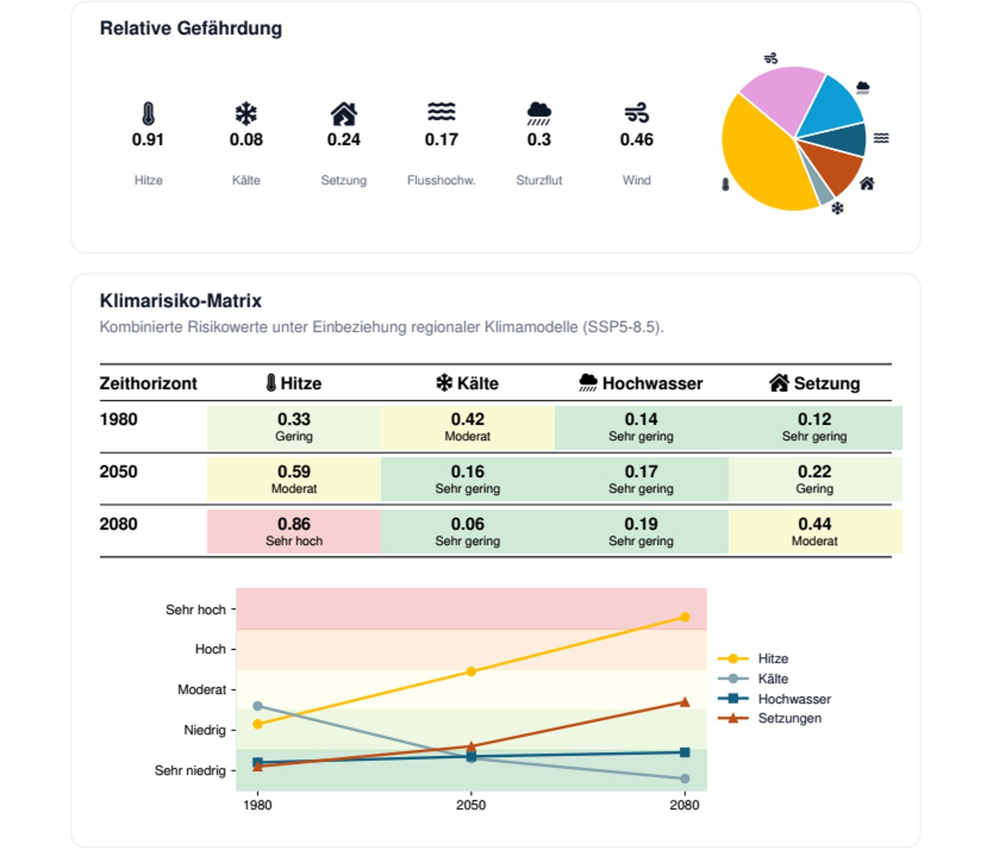
Climate impacts at a glance
For the complete building stock, we developed an atlas of climate impact for every building distributed over 6 primary perils
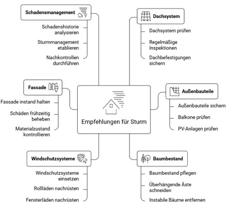
For every perils, there are vulnerabilities and solutions
For each peril, we developed a tailored collection of vulnerability indicators and recommendations for resendential housing to identify current weakness and future improvements.
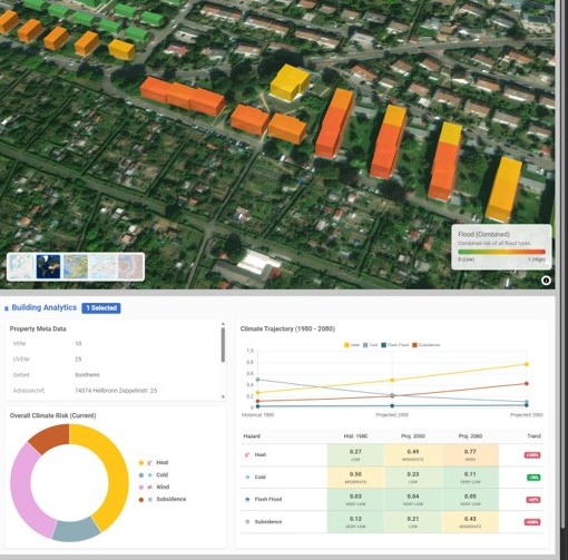
Aggregating all assessment results in one platform
The next logical step is the integration of all risk modelling data and the vulnerability into a concise and user-friendly web platform.